Mountain Balds in the Great Smoky Mountains National Park
The Smoky Mountains are one of the largest sections of forest in the Southeast US and they encompass over 800 square miles of the Southern Appalachian Mountains. For all of their grandeur, some of its most stunning features aren't found among the trees, but in the fields.
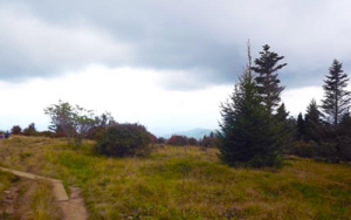
High elevation fields, known as balds, provide some of the most jaw dropping views in the Great Smoky Mountains. Like their name suggests, these fields are "bald" spots on the mountains that offer hikers panoramic views and unmatched natural beauty. So we made a list of the 5 most stunning balds in the Smoky Mountains.
There are 10 or so high elevation balds in the Great Smoky Mountains National Park. Many of these balds sit at elevations above 5,000 Feet which makes these balds a hot bed for seeing flora and fauna. Even better, these balds are often located on mountain ridges and provide views of both the Tennessee and North Carolina side of the Smokies.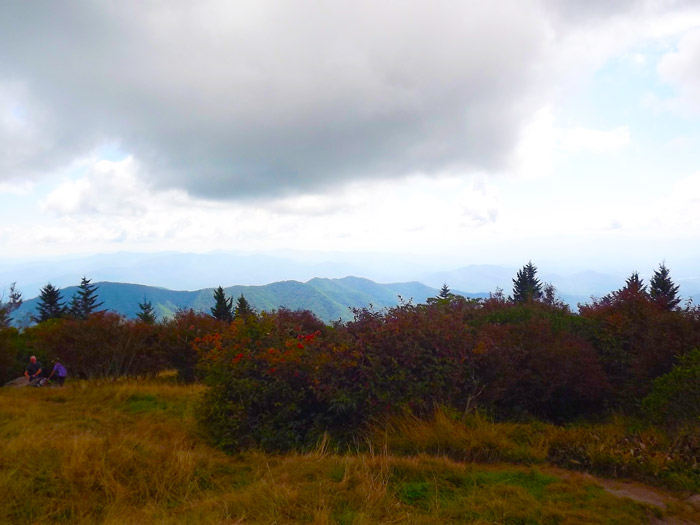
History
Though balds in the Smokies offer hikers a beautiful mountain destination for hikers, they also offer a mystery for scientists. Since the arrival of European settlers to the Smokies, some of these balds have been used as pastures for grazing animals. It's likely that early settlers cleared mountain ridges to raise cattle and sheep, but there's also evidence that some balds predated European settlement.
By the late 1800s, grassy balds dominated the high ridge of the Smokies. At one time, the largest meadow stretched over 24 miles from Silers Bald near Clingman's Dome to Gregory's Bald. The Appalachian Trail in the Smokies follows most of what was once a truly massive field.
Though the origins of Smoky Mountain balds are mysterious, they are undoubtedly a beautiful and unique feature to explore in the national park.
Today, the park service maintains two balds in the Smoky Mountains for conservation purposes: Gregorys Bald and Andrews Bald. These two fields are believed to be "natural balds" in the Smokies. Without this maintenance, high mountain balds become overrun with brush and eventually return to the forest.
Hiking Trails
Mountain balds in the national park are some of the best hiking trails with views in the Smokies. The catch is that most of these trails are long and strenuous. Most grassy balds and heath balds in the Smoky Mountains are located near the Appalachian trail, so you can expect hiking trails with steep elevation gains.
Here is a list of the 5 most popular balds in the Great Smoky Mountains National Park:
1. Andrews Bald
- Trail: Forney Ridge Trail
- Round Trip Distance: 3.5 Miles
- Elevation: 5,906 Ft
- Highlights: Panoramic Views, Highest Bald in the Smokies
- Directions: Drive to the Newfound Gap Parking area and turn onto the Clingman's Dome Road. Drive for 7 miles until you reach the parking area. Next to the Clingman's Dome trail to the observation tower, you'll see a sign for the Forney Ridge trail.
On this trail, you'll descend through a Frazier Fir forest to reach that's only a short hike away from the parking area. Andrews Bald is the easiest bald to access and is the least strenuous hike you can take to experience a high elevation bald in the Smokies.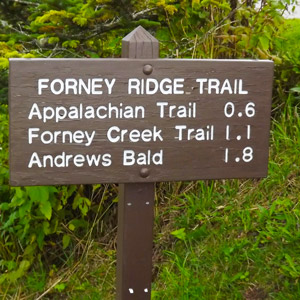
Insider Tip: Clingman's Dome Road is closed during the winter, so it is best to enjoy this hike in the summer.
2. Silers Bald
- Trail: Forney Ridge Trail, Appalachian Trail
- Round Trip Distance: 9.3 Miles
- Elevation: 5,607 Ft
- Highlights: Mountain Views, Vistas from the Appalachian Trail
- Directions: Drive to Newfound Gap in the national park and take the Clingman's Dome Road for 7 miles to the parking area at the end of the road. Take the Forney Ridge Trail and turn right. Then turn left onto the Appalachian trail after 0.5 miles.
This hike follows a beautiful section of the Appalachian trail as it steeply descends from Clingman's Dome. This hike is especially strenuous and the return trip can be quite brutal. Luckily, since this trail straddles the high ridge of the Smokies, you will have the chance to enjoy glimpses of great views on your way to the bald. In the last 2 miles before you reach Silers Bald, you will pass through a section called "the narrows," where the trail is only a few yards wide with steep precipices on either side.
3. Gregory Bald
- Trail: Gregory Bald Trail
- Round Trip Distance: 10 Miles
- Elevation: 4,948 Ft
- Highlights: Panoramic Views, Flame Azaleas bloom in summer
- Directions: Take the Cades Cove Loop Road to the Visitor Center just after the halfway point. Turn right onto Parson Branch Road. After a few miles, hikers will reach the trail head.
 As one of the lower balds in the national park, Gregory Bald is one of the easier balds to reach, though it will require a day hike to reach the summit. The trail is well maintained and requires only one stream crossing. In addition to 360 views of the Smoky Mountains, this field harbors a large patch of Flame Azaleas that bloom gorgeous orange, red, and yellow in June.
Insider Tip: Parson's Branch Road is closed during the winter season. Also, Gregory Bald is sometimes closed due to bear activity since there are large blueberry bushes on this mountain bald.
4. Maddron Bald
- Trail: Snake Den Mountain Trail
- Round Trip Distance: 8.8 Miles
- Elevation: 5,212 Ft
- Highlights: One of the largest heath balds in the Smokies.
- Directions: Drive Hwy 321 East and turn right onto Tennessee Route 32 to reach the Cosby region of the National Park.
This trail is a continuous climb to Maddron Bald. It begins along an old service road, but becomes increasingly steep and rocky as you near the summit. On the way, hikers will pass through high elevation, old growth forest. This Heath Bald in the Smokies features beautiful views of one of the most rugged sections of the Smokies.
5. Spence Field
- Trail: Lead Cove Trail, Bote Mountain Trail, and the Appalachian Trail
- Round Trip Distance: 9.9 Miles
- Elevation: 4,920 Ft
- Highlights: High elevation forest, views of Rocky Top, and views of the North Carolina Smokies.
- Directions: From the Townsend "Wye," drive towards Cades Cove for 5.6 miles. Before you reach the entrance to the Cades Cove Loop, you'll find the trail head for Lead Cove Trail that shares a parking area with several other trails including Finley Cane and Turkey Pen Ridge. Once hikers on Bote Mountain Trail reach the Appalachian Trail, turn left to reach Spence Field, though a sign will point hikers to the right towards the Spence Field Shelter.
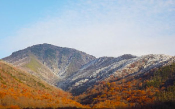
Lead Cove trail is the shortest way to reach Spence Field, but it is also the steepest route. An alternative route would be taking Anthony Creek Trail to Bote Mountain Trail and continuing onto the Appalachian Trail. Spence Field is a grassy field that straddles the Tennessee boarder with North Carolina. The views are spectacular any time of year. If there is time, hikers can continue a few miles further to reach Rocky Top. Though the hike is strenuous, the views do not disappoint. These photos were taken in the winter after a period of snowfall.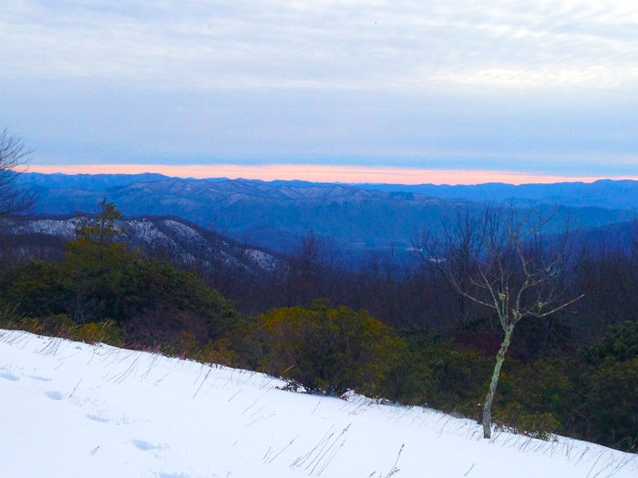
Final Thoughts on Balds in the Smokies
High elevation balds in the Smoky Mountain offer some of the most spectacular vistas in the Tennessee mountains. Families and groups staying in Smoky Mountain cabin rentals may be interested in scheduling a day to reach on of these spectacular mountain ecosystems. Though they require challenging hikes to reach, these stunning points along the high ridge of the Smokies are a true treasure due to their unique habitats and mountain views.
Written by Hayden Brown


